Menu

Maps

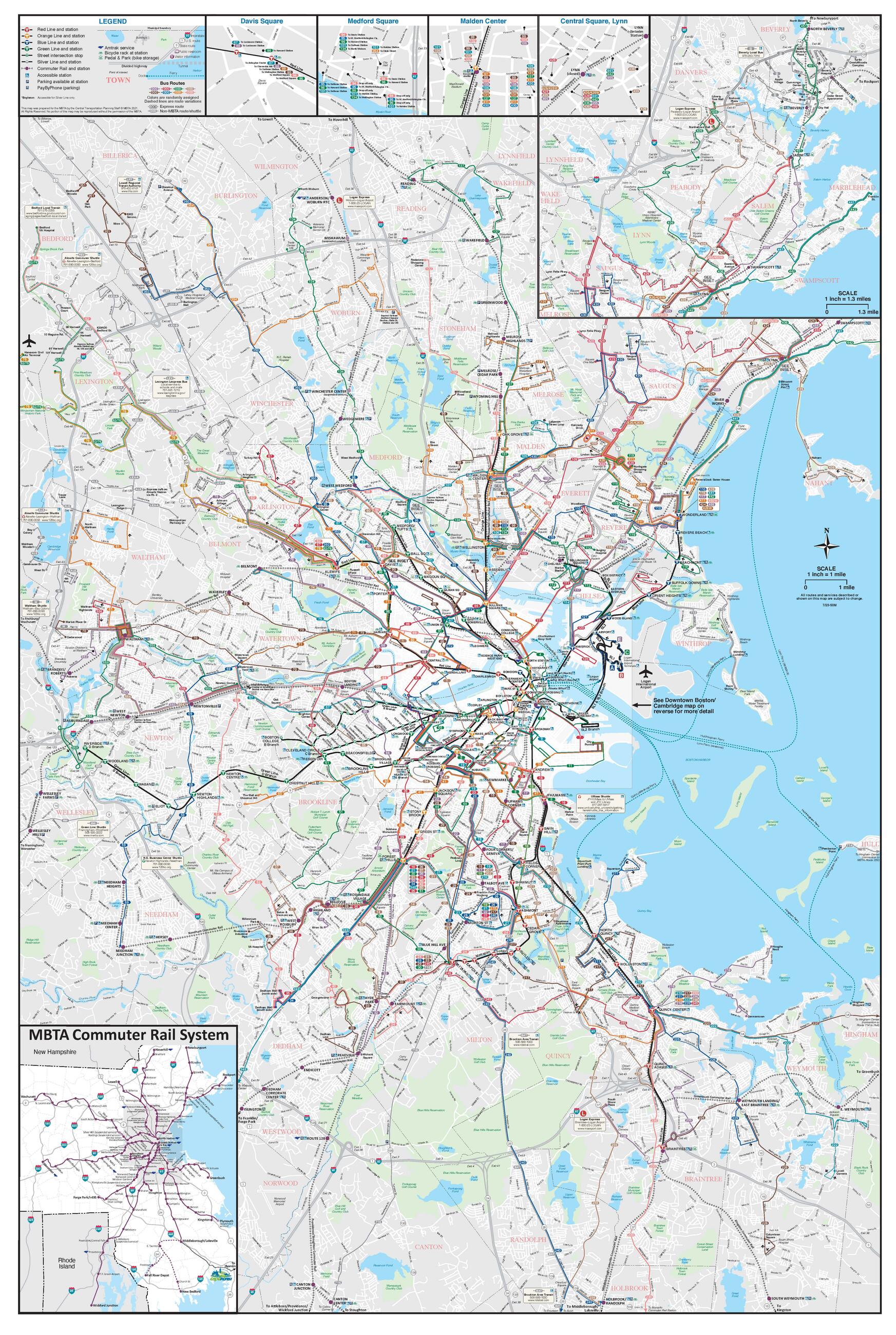
Full System Map

subway bus commuter rail ferry

View full map as PDF

Map of MBTA full system
The system map includes all subway lines, bus routes, Commuter Rail lines, and ferry routes.

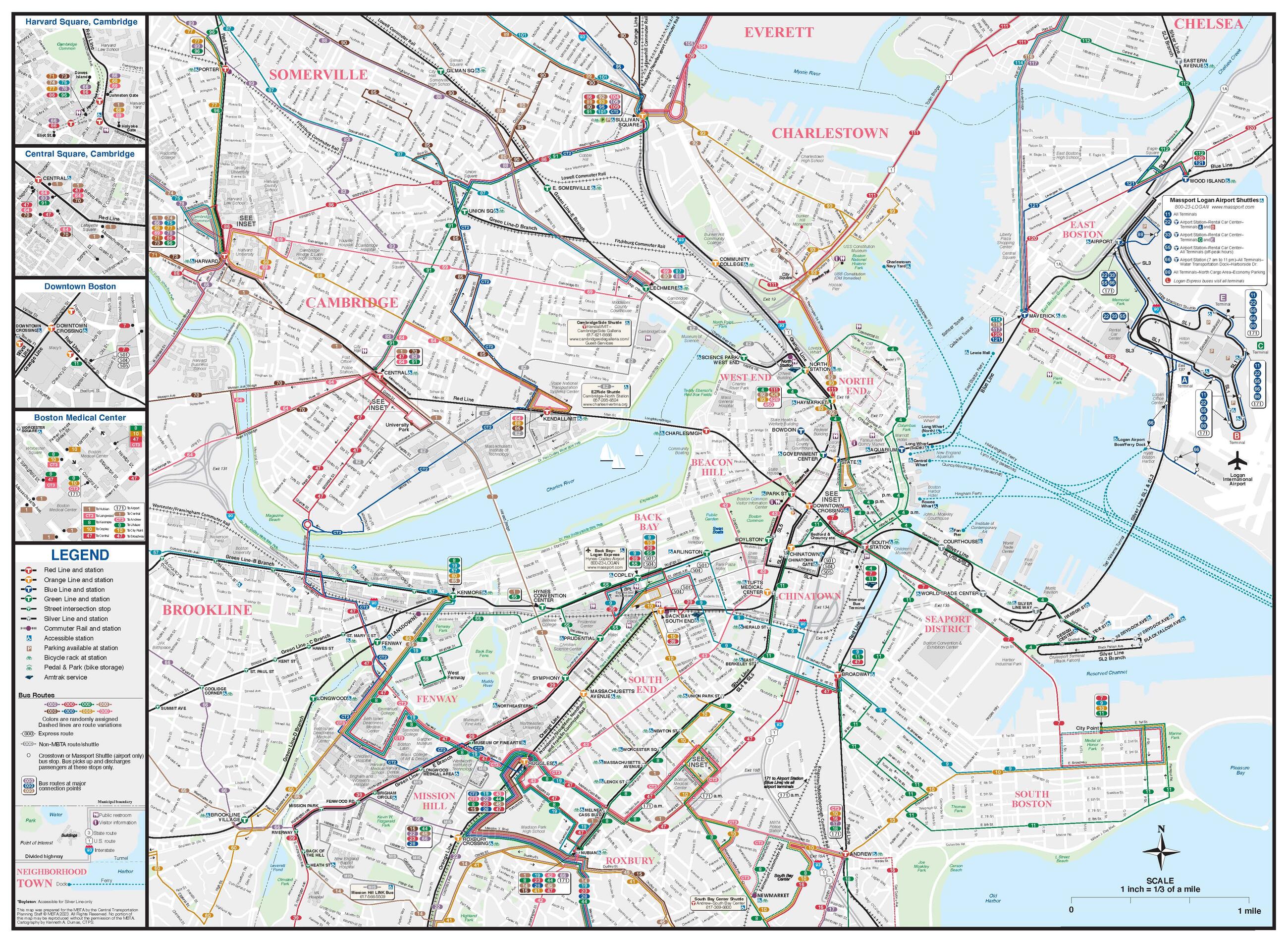
Downtown Map

subway bus commuter rail ferry

View full map as PDF

Map of Downtown Boston transit
This map includes portions of Boston, Brookline, Cambridge, Charlestown, and Somerville.

Subway Map

subway silver line bus commuter rail

View full map as PDF

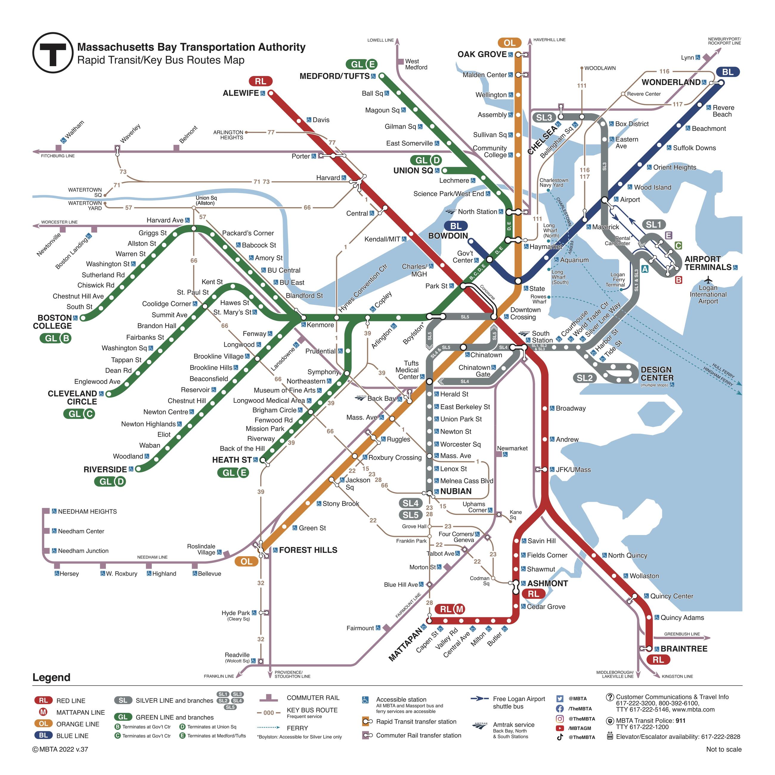
Subway map, rapid transit and key bus routes
This map emphasizes the subway and Silver Line. It also includes key bus routes and Commuter Rail lines.

Ferry Map

ferry

View full map as PDF

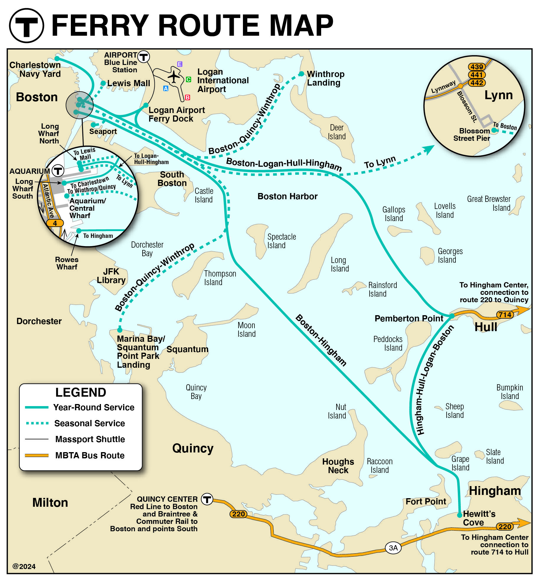
Harbor map showing both seasonal and year-round ferry routes
This map includes the Hingham/Hull, Charlestown, and East Boston ferry.

Commuter Rail Map

commuter rail

View full map as PDF

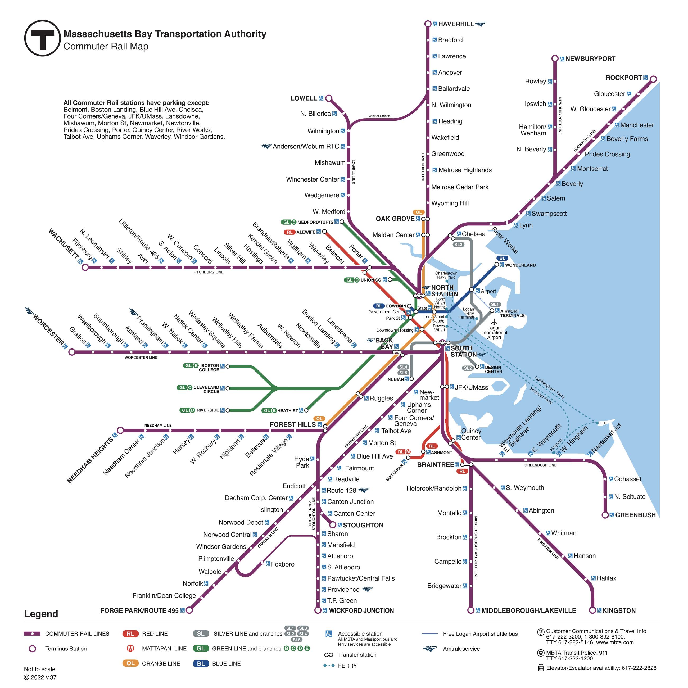
Commuter rail map
This map includes all Commuter Rail lines and select subway stations.

Commuter Rail Zones

commuter rail

View full map as PDF

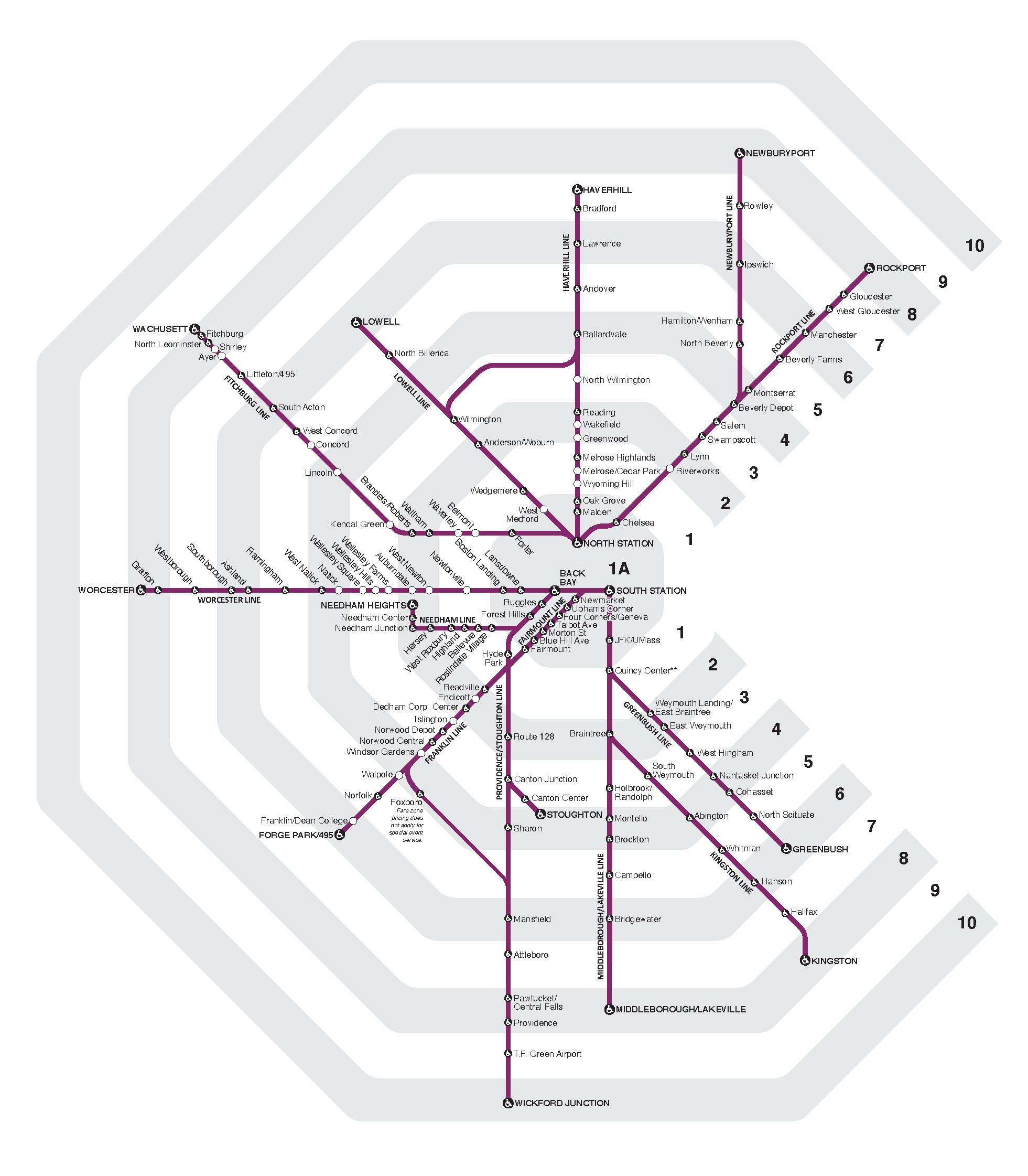
Map of commuter rail fare zones
This map includes all Commuter Rail fare zones (Zone 1A - Zone 10).

New to the T?

Clickable graphic for User Guides

Find your way around the Greater Boston area on the T with help from our user guides.
Learn more with our user guides

View schedules

Plan a trip

New to the T?

Clickable graphic for User Guides

Find your way around the Greater Boston area on the T with help from our user guides.
Learn more with our user guides

View schedules

Plan a trip